Things to Do in Death Valley National Park
Death Valley National Park is one of nine National Parks in California. It has the hottest-recorded temperatures on Earth (134ºF) and the lowest sea level in North America (-282 ft).
There are a variety of unique sights to see in Death Valley, from salt flats to colorful dirt deposits. It wasn’t too crowded at all and is easily accessible by car. We didn’t do any hikes and still got to see all the sights we wanted to see!
This post contains affiliate links that earn me a commission. For more information, read my disclaimer.
How to Get There
We stayed at Panamint Springs Motel & Tents and had about an hour drive into the park. If you’re coming from the west, it’s an easy (but long) drive into the park along one road.
I used Roadtrippers Plus to plan our trip! It was incredibly useful to add in each stop and get a clear idea of how long it takes to get to each location. You can click my affiliate link above or use code BTR5QTP to get $5 off when you subscribe to Roadtrippers Plus.
What to Bring
Sun Protection
Pack a hat, sunglasses, and apply/reapply sunscreen! Death Valley is extremely hot and dry. In summer the temps get unbearable after 10am and hikes are not recommended. Visit in Spring or Fall for more tolerable weather.
We visited in April and it was already 100ºF by 11am. Plan accordingly!
My recommendations:

Snacks & Hydration
Don’t forget to fill up a large water bottle. I like to bring my 64oz stainless steel water bottle so I don’t have to refill and it keeps my water ice cold all day.
If you’re planning to spend a long time in the park, having snacks (or even a packed lunch in a cooler) is ideal!
Cameras
I brought my Canon R5 with a 15-35mm RF lens, as well as a pack of Fujifilm disposable cameras to shoot photos throughout our trip. If you already have a digital camera, getting a disposable is really fun and the photos turn out so well!
Things to Do
Death Valley has a nice variety of things to see and do. I really loved that you can see everything easily without hiking (we are not hikers!).
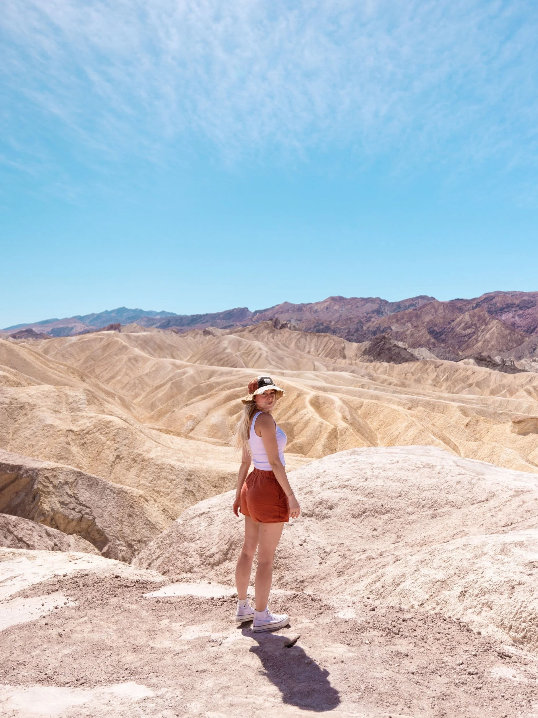
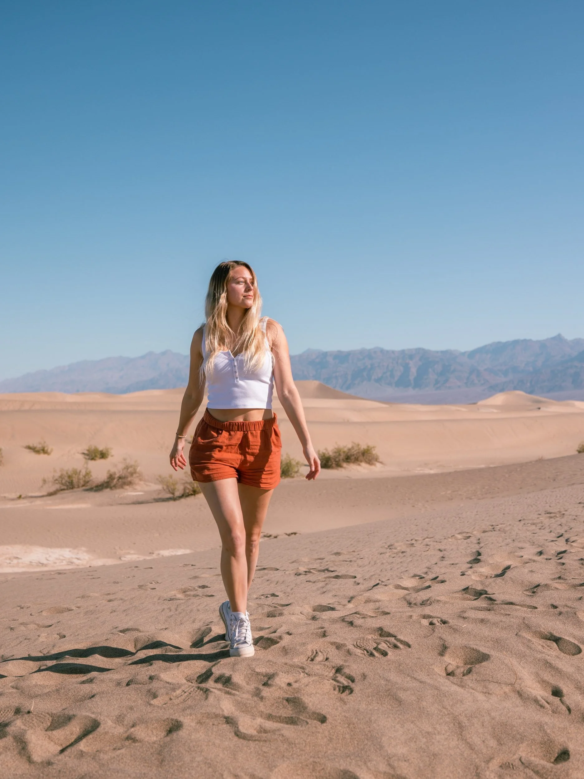
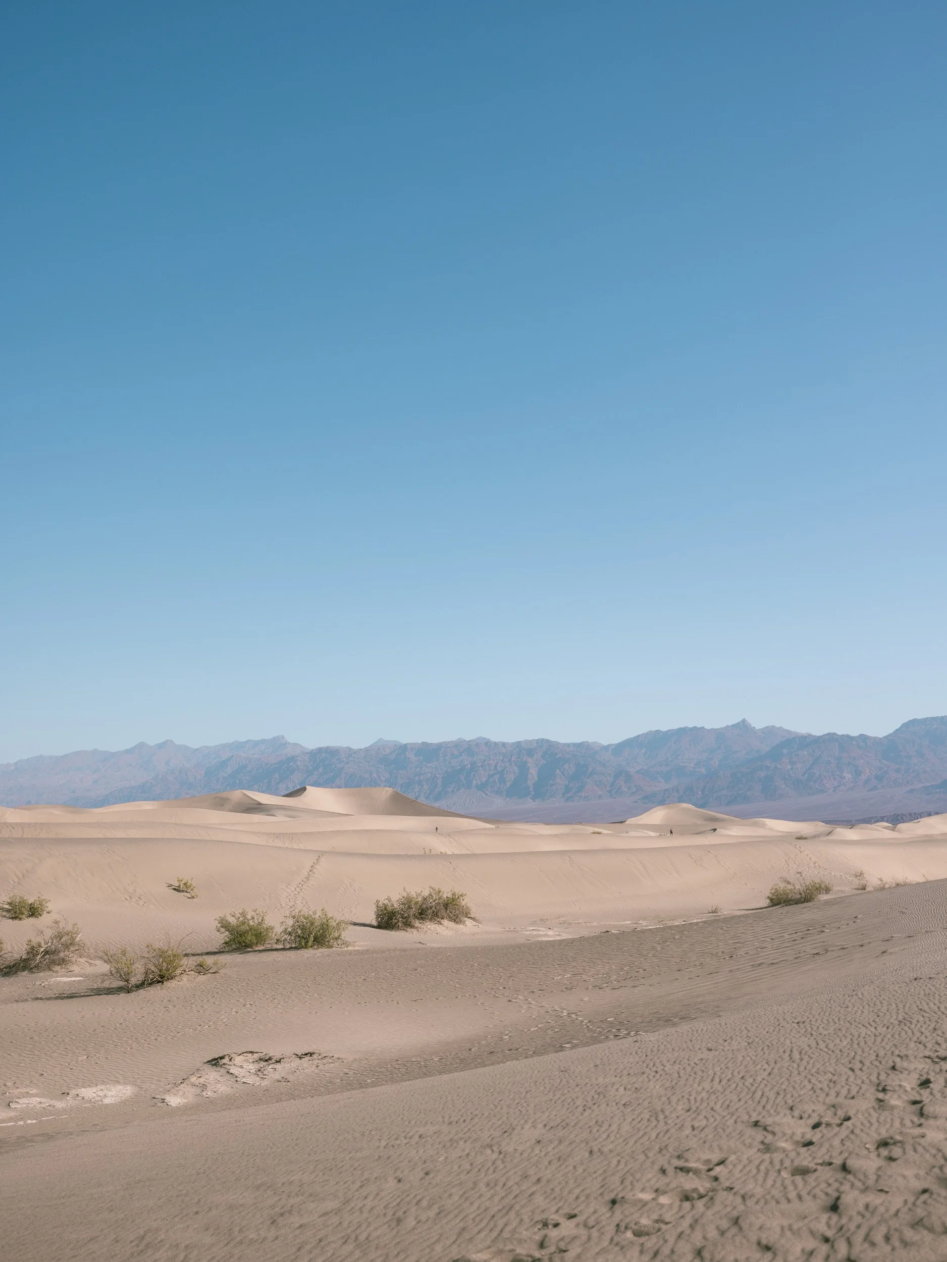
Mesquite Sand Dunes
If you’re coming from the west, this will likely be the first thing you stop at. Since we stayed in a cabin at Panamint Springs Motel & Tents, the sand dunes were the first thing we hit once we got into the park.
They’re before the visitor center, so you could technically see these without paying the fee to get in. They’re vast and the walk out is much longer than it looks. Bring water and cover up if you’re prone to sunburns.
Visitor Center
Make sure you stop at the Visitor Center to purchase your day pass or show your America the Beautiful Annual Pass. You’ll get a piece of paper with the dates to display on your dashboard - don’t skip this!
You can also get a free map here as well. Highly recommend it!
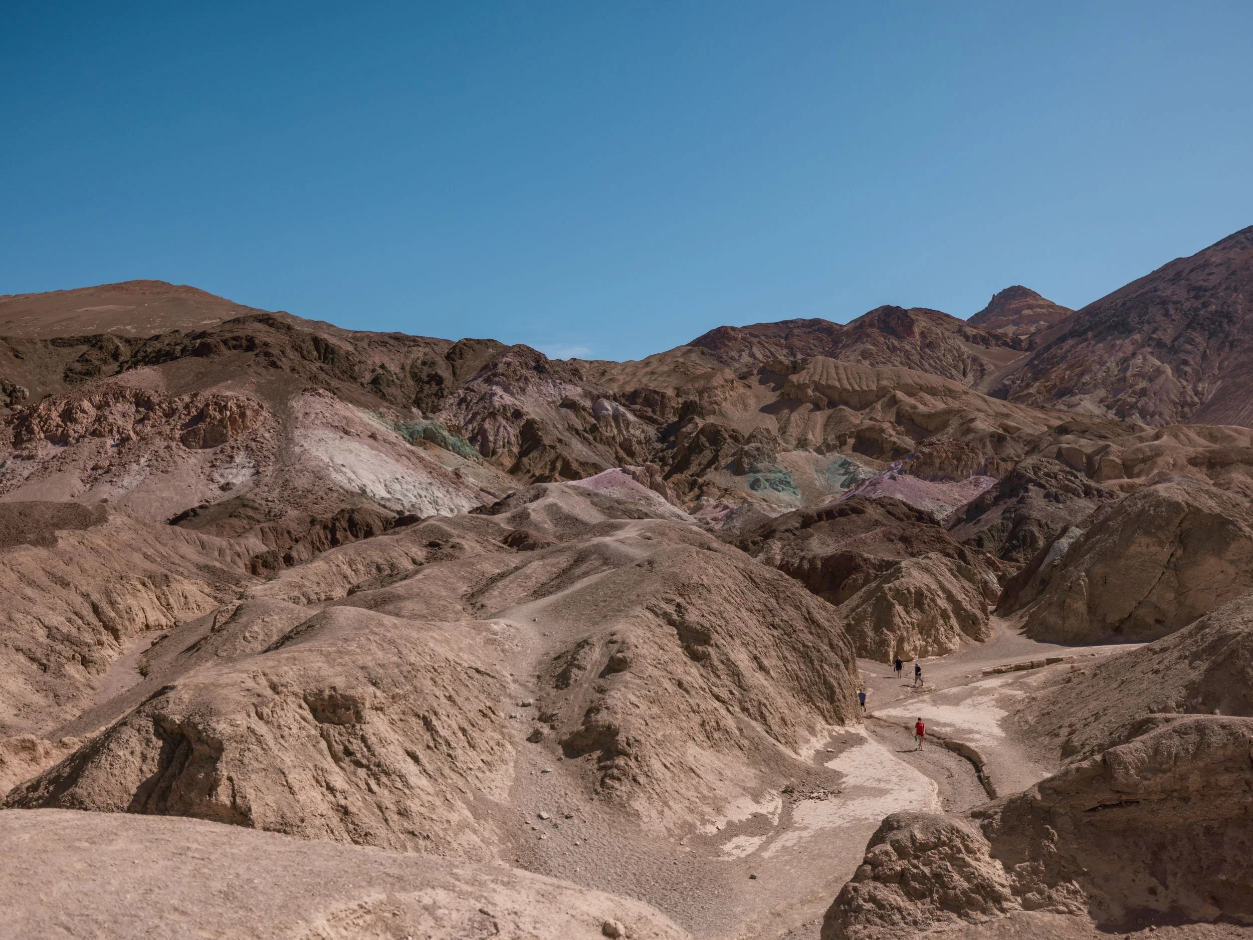
Artist’s Palette Drive
Millions of years ago there were volcanic eruptions here that deposited all kinds of minerals onto the soil. It now has a rainbow of colors from pink to blue to yellow that can be seen along this drive.
Midday isn’t the best time to see them, as the sun seems to wash out all the color. Sunrise or sunset would probably be best! Most of the photos you see from this spot are also probably edited to bring out the colors more. See my before/after photos below.
There is a hike you can do through the colorful hills, but we didn’t do it – next time!


Devil’s Golf Course
We didn’t end up stopping here during our visit, but if spiky formations of rock salt pique your interest, definitely stop here! This spot was named because the rock salt is so spiky that “only the devil could play golf on such rough links.”
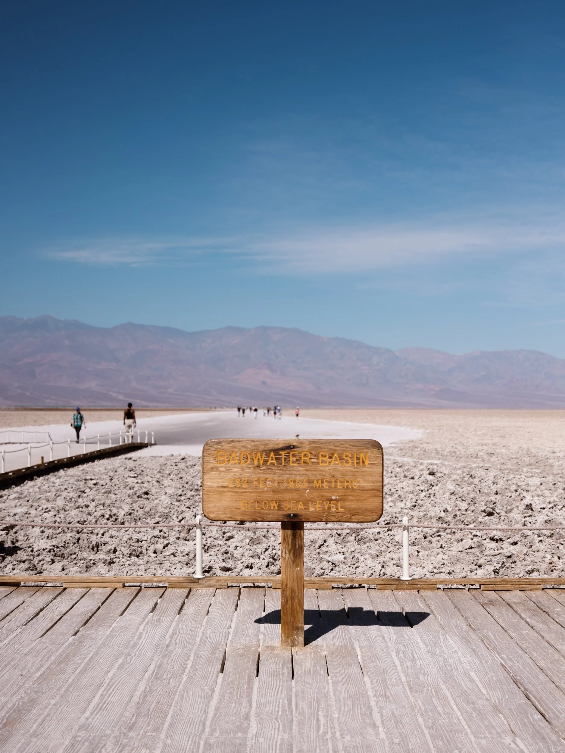
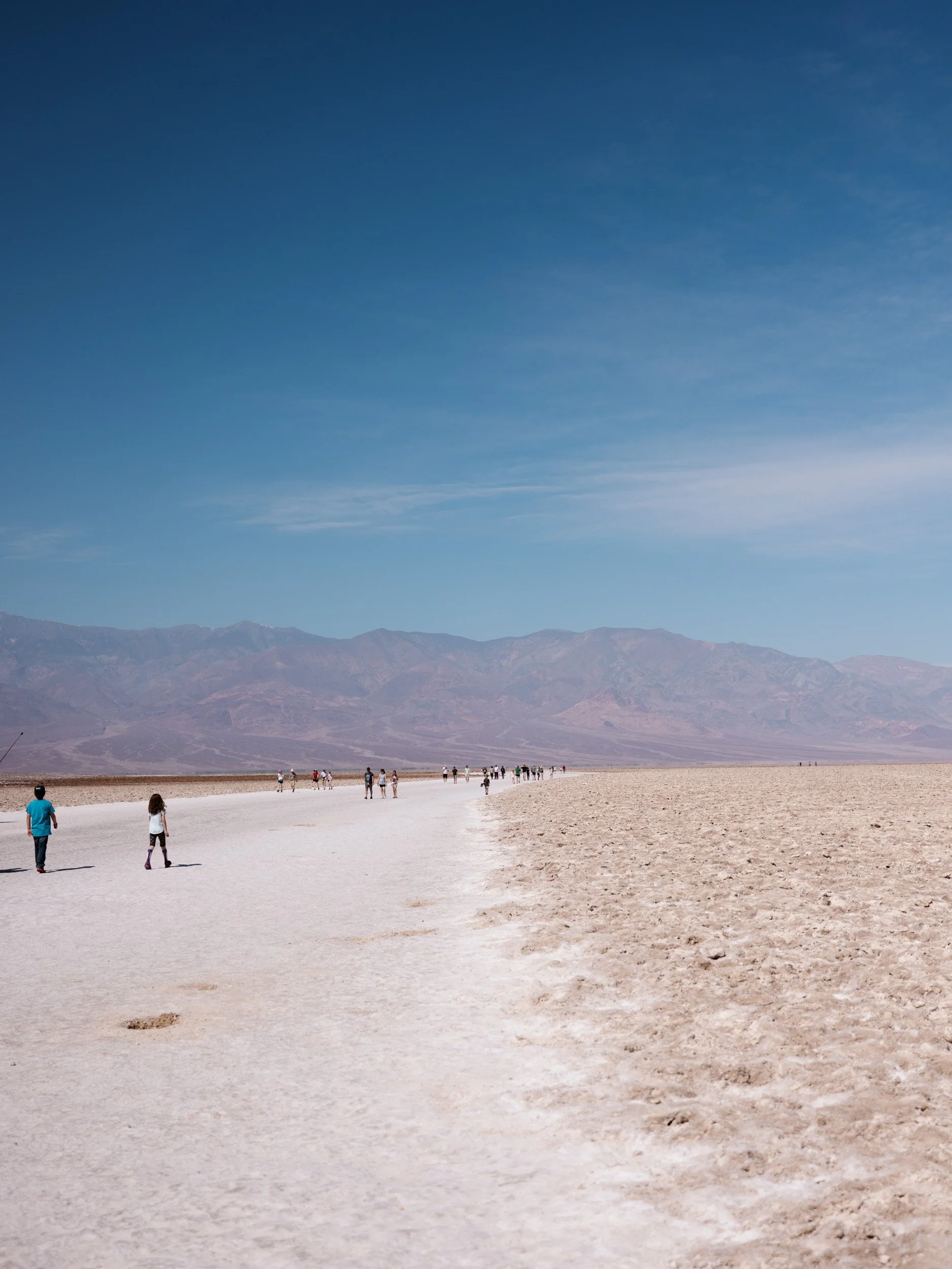
Badwater Basin
According to a sign at Badwater Basin, these salt flats got their name from a traveler who stopped here with his mule. His mule wouldn’t drink water, so he gave this area the name “Badwater,” despite the water not actually being bad – just salty.
Badwater Basin is the lowest point in North America at 282 feet (86 m) below sea level. It’s just a few steps from the parking lot, which makes this an easy stop. You can walk out further to the more-pristine salt flats if you’re up for a 1.5-2 mile walk round trip out and back.
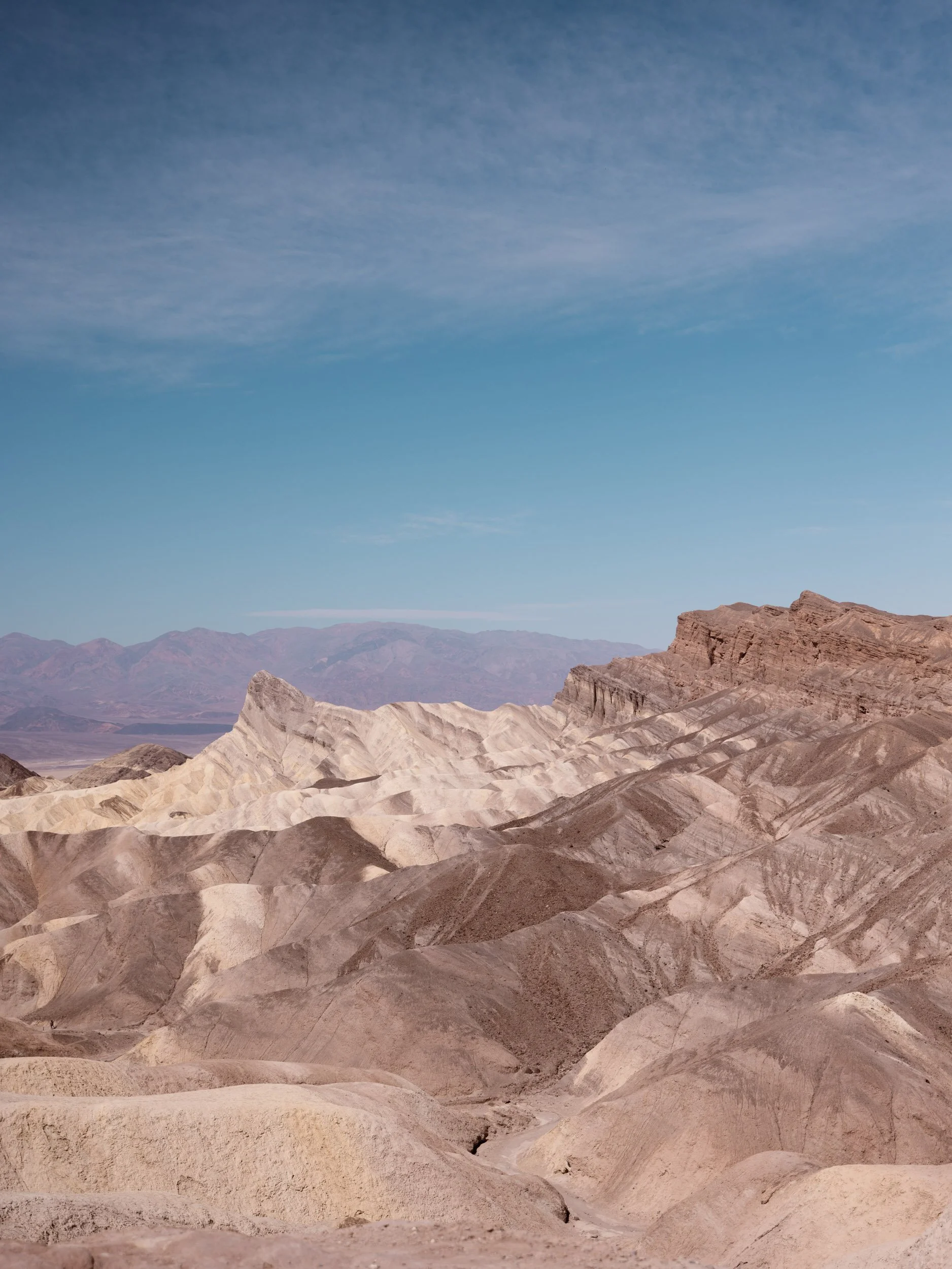
Zabriskie Point
Our last stop in the park on the way out was Zabriskie Point.
Once you park in the lot, walk up the hill to the top lookout spot for the best views of the badlands below! Zabriskie Point has brown and tan stripes running through it and was formed by water many years ago.
You can hike the Badlands Loop Trail, which starts at the parking lot, or just check out the views from the top lookout point.