How to Spend One Day in Valley of Fire State Park
Valley of Fire is a gorgeous state park you do not want to miss! It’s just one hour away from Las Vegas, which makes it an easy day trip from there.
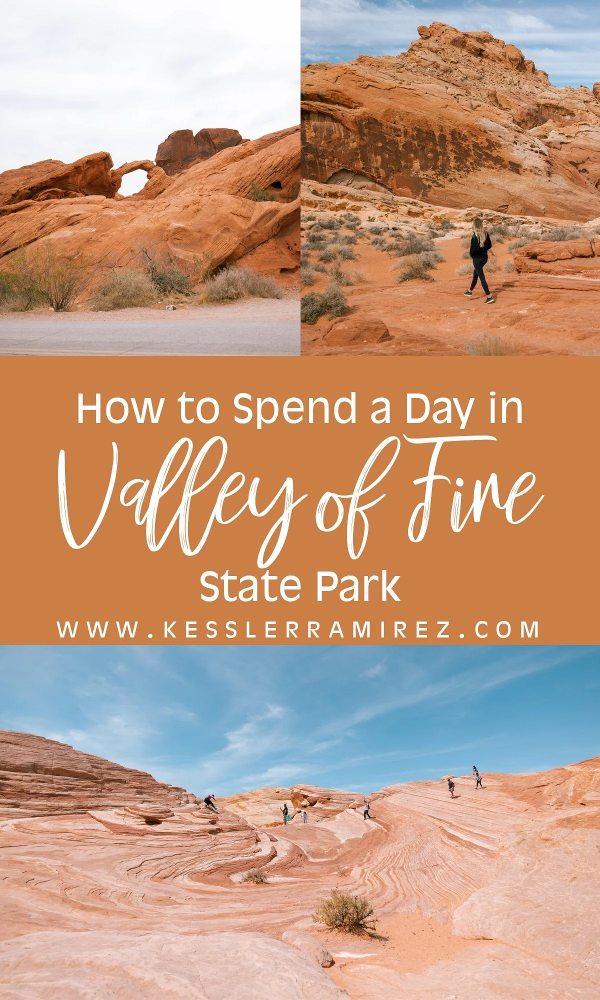
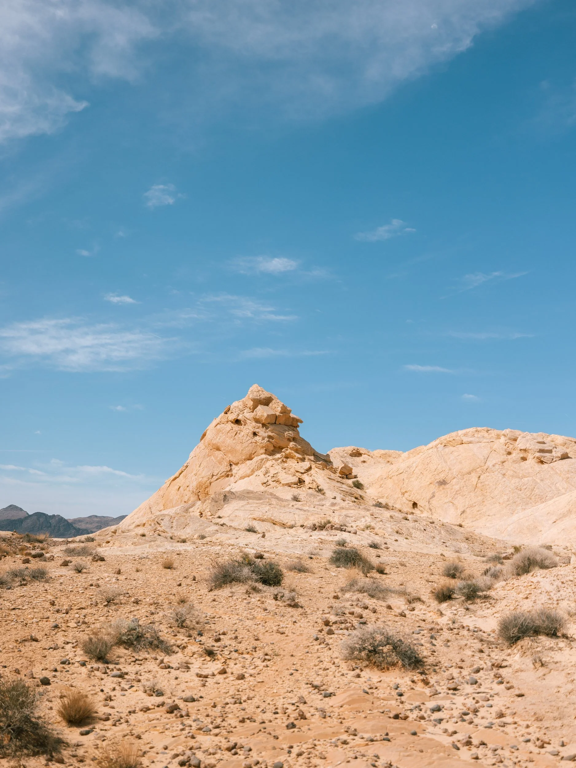
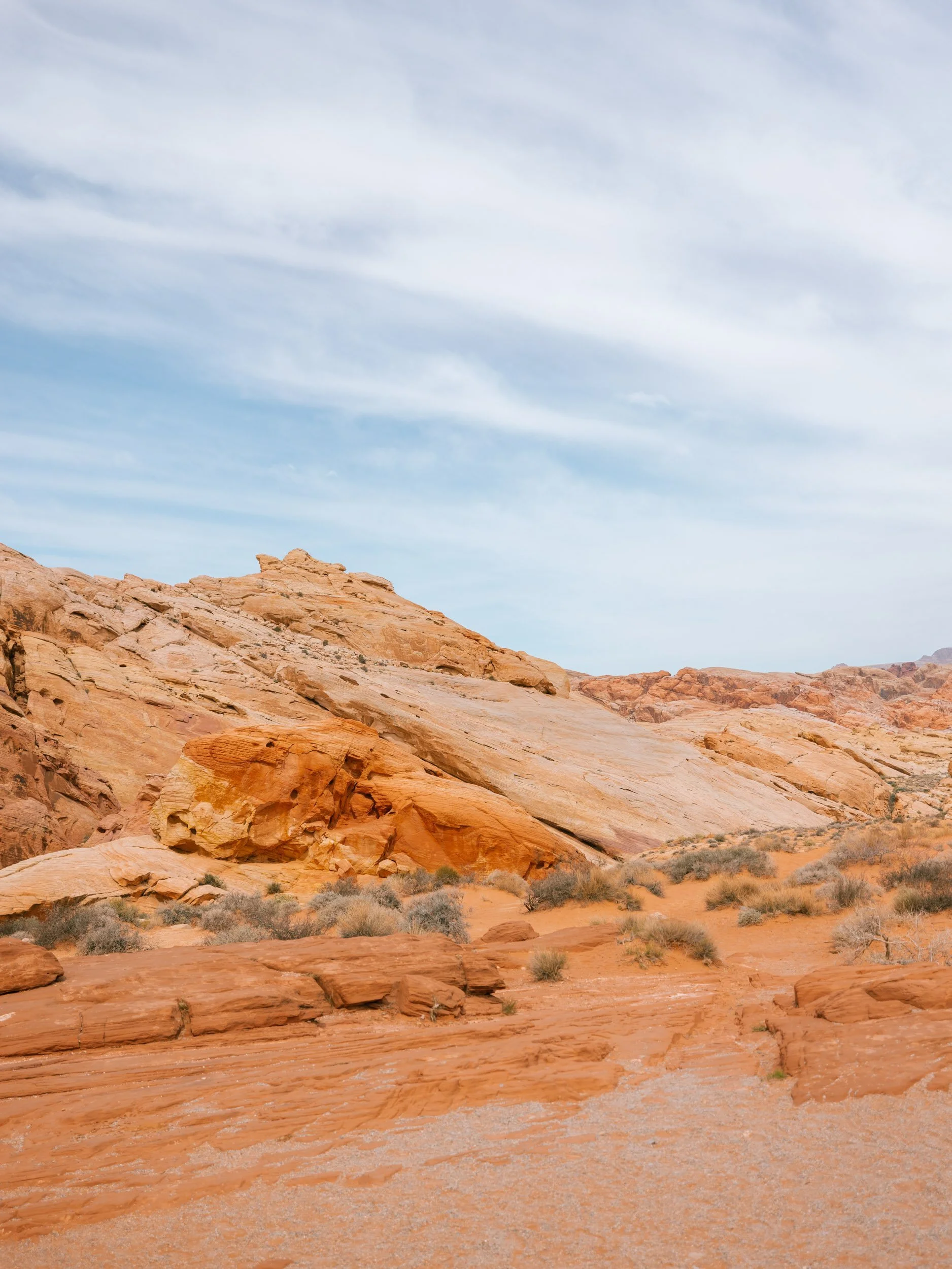
Valley of Fire State Park is probably most well-known for the red, gray, and tan stripes in the stone made from red Aztec sandstone and limestone. It also has large, orange rock formations and even its own little arch!
We stopped here on our way from Las Vegas to Zion National Park! It was the only state park we visited on our road trip and it was worth the extra stop.
This post contains affiliate links that earn me a commission. For more information, read my disclaimer.
How to Get There
If you’re coming from Las Vegas, it’s an easy 1-hour drive up I-15 North and then you’ll turn right onto Valley of Fire Highway and follow it until you reach the front entrance!
From there, you can get a free map at the entrance and/or follow posted signs to see all areas of the park.
I used Roadtrippers Plus to plan our trip! It was incredibly useful to add in each stop and get a clear idea of how long it takes to get to each location. You can click my affiliate link above or use code BTR5QTP to get $5 off when you subscribe to Roadtrippers Plus.
Things to Do
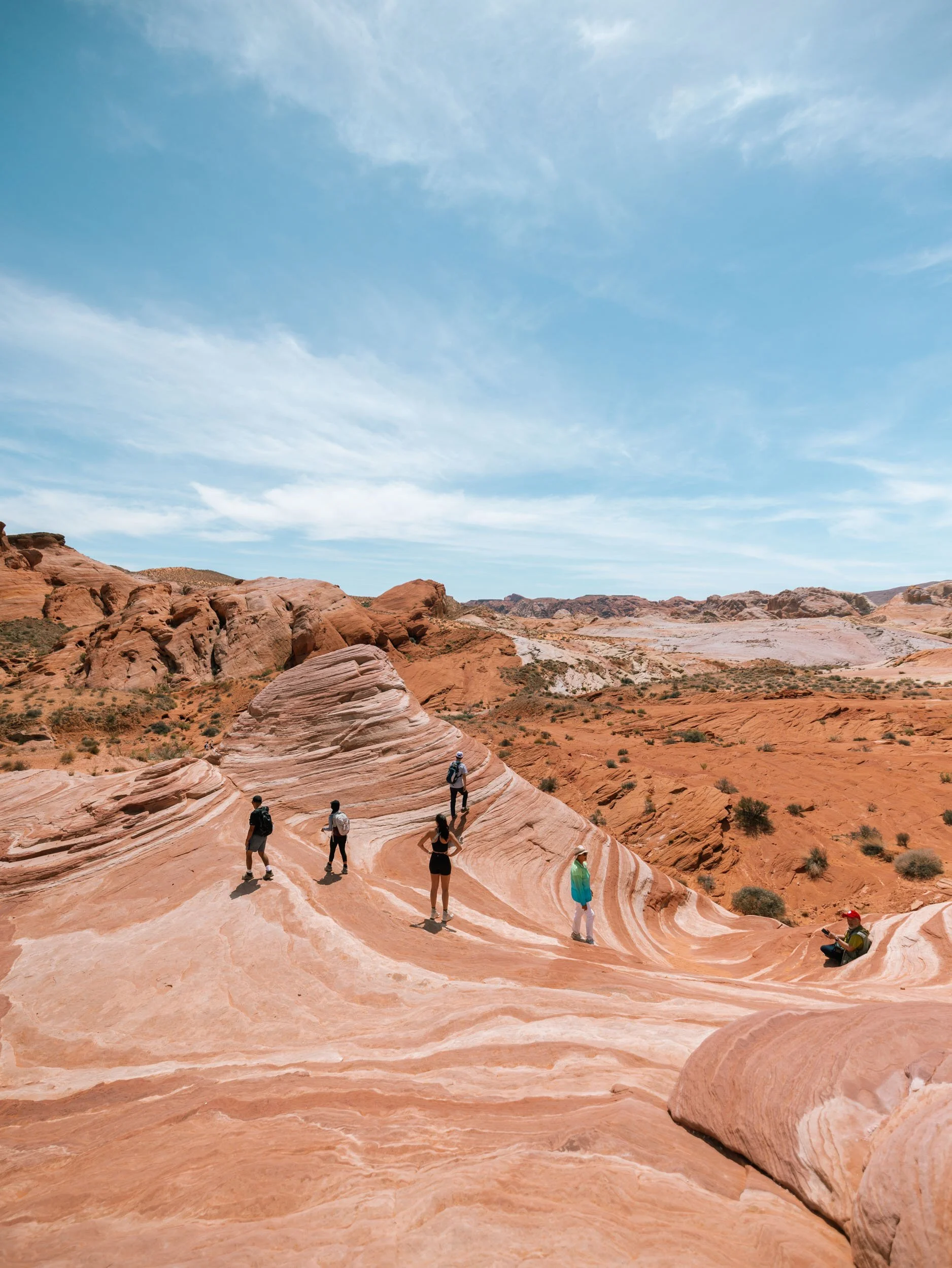
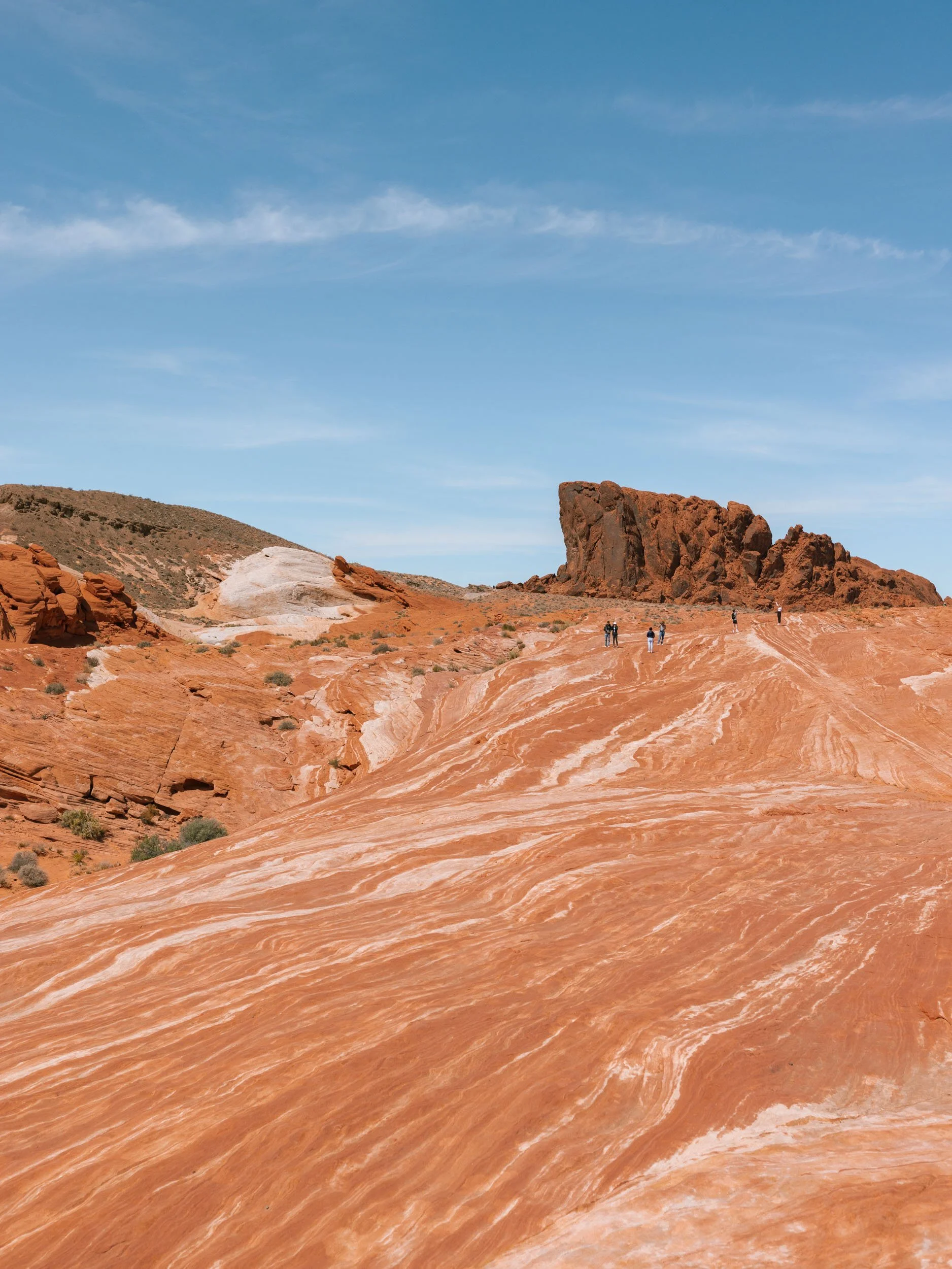
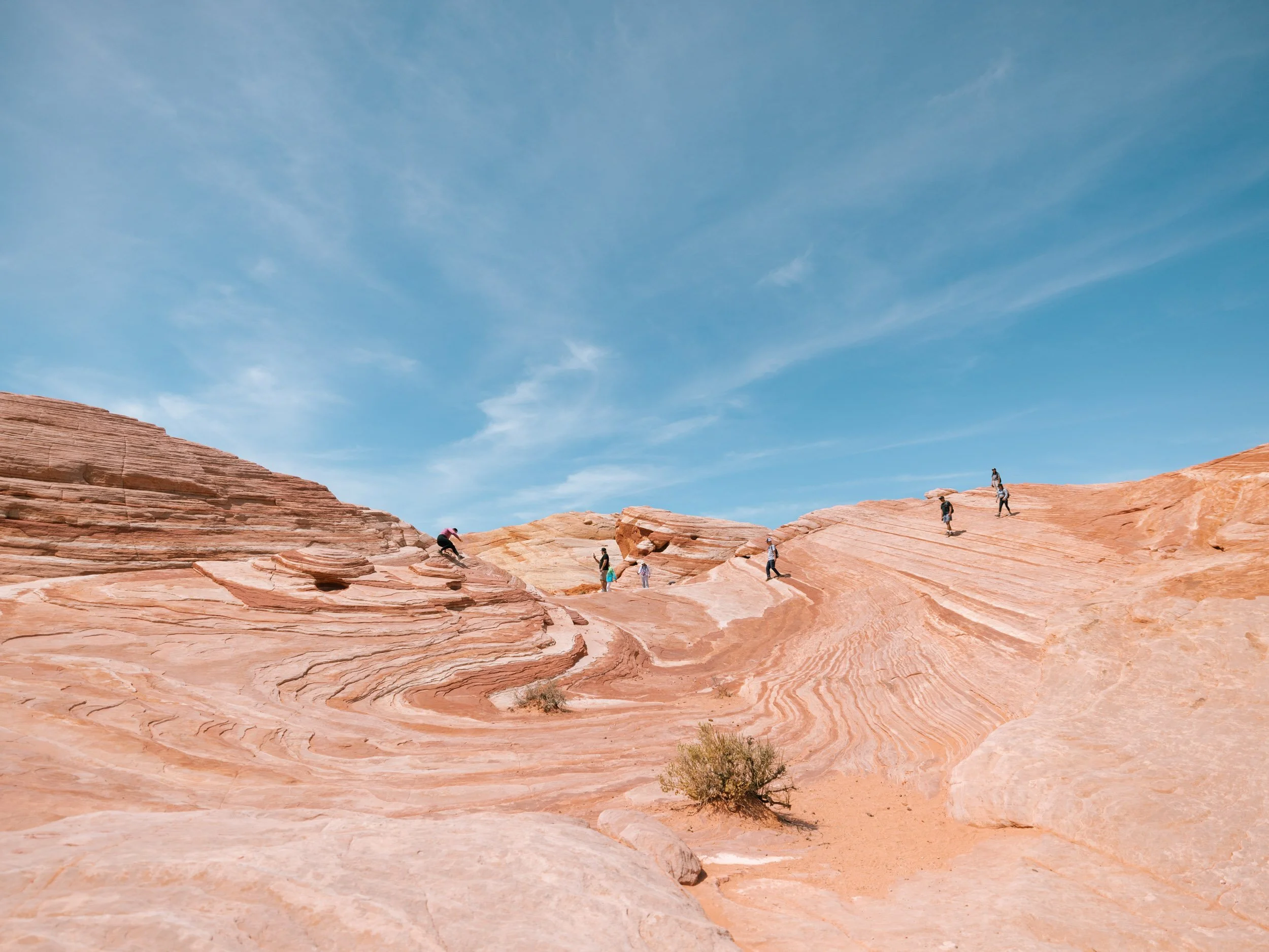
Fire Wave Hike
This was the thing I was most excited to see, and I definitely wasn’t alone in that. It was by far the most busy area of the park, although still not as crowded as some other parks I’ve been to.
The parking lot was a bit of a zoo. We got really lucky with a guy who asked if we wanted his spot and make sure to block any other cars from taking it so we could pull in (thank you, kind man!).
If you’re planning to see the Fire Wave, drive to it first thing before it gets too crowded! It’s about a 1-1.5 mile round-trip walk through sand and over the stone. I found it really easy!
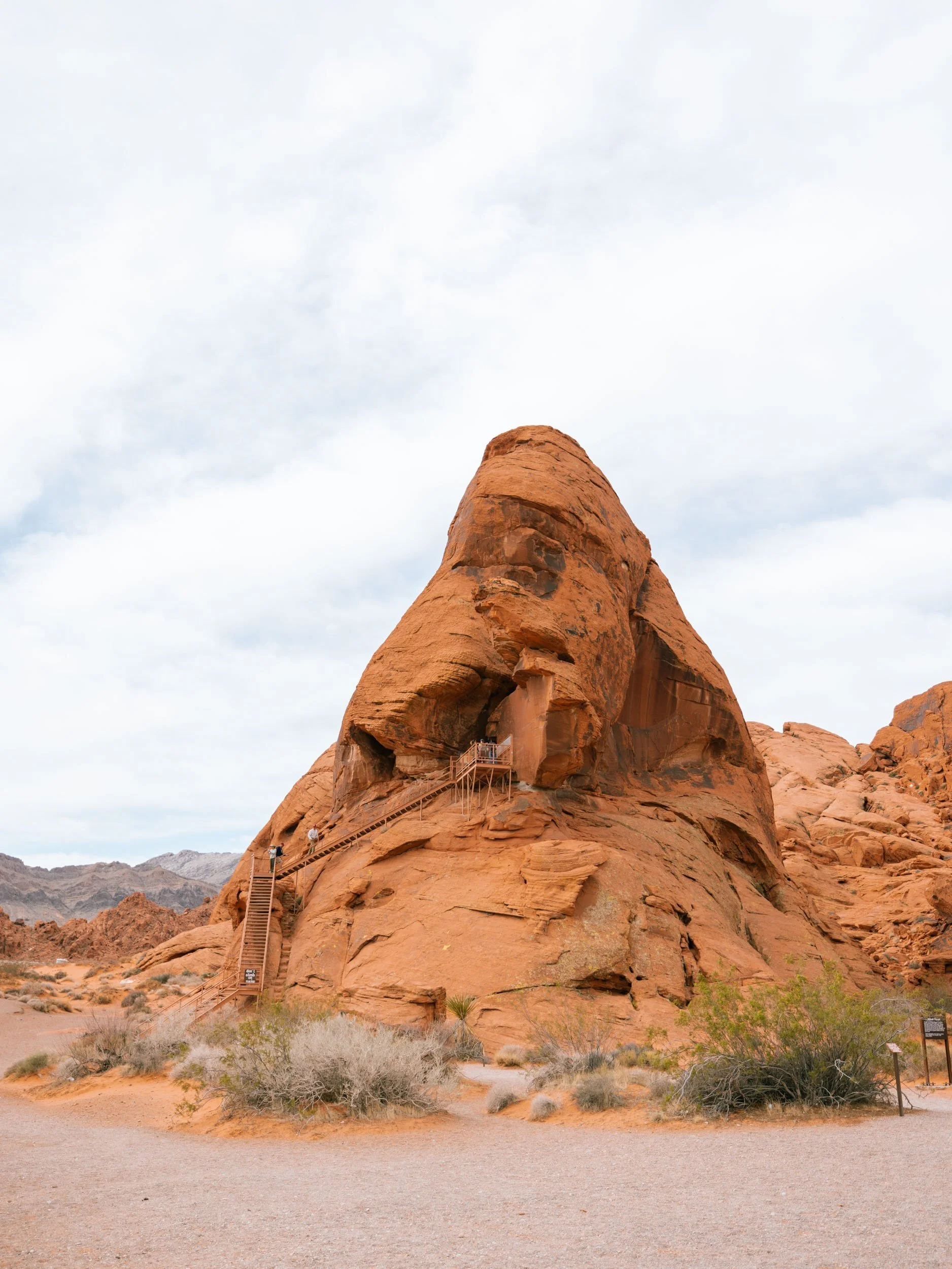
Atlatl rock
This uniquely shaped rock actually has a staircase built into it! You can climb the stairs up the rock for some great views. There’s a decent-sized parking lot here that only had a few cars in it when we arrived, which made it an easy stop!
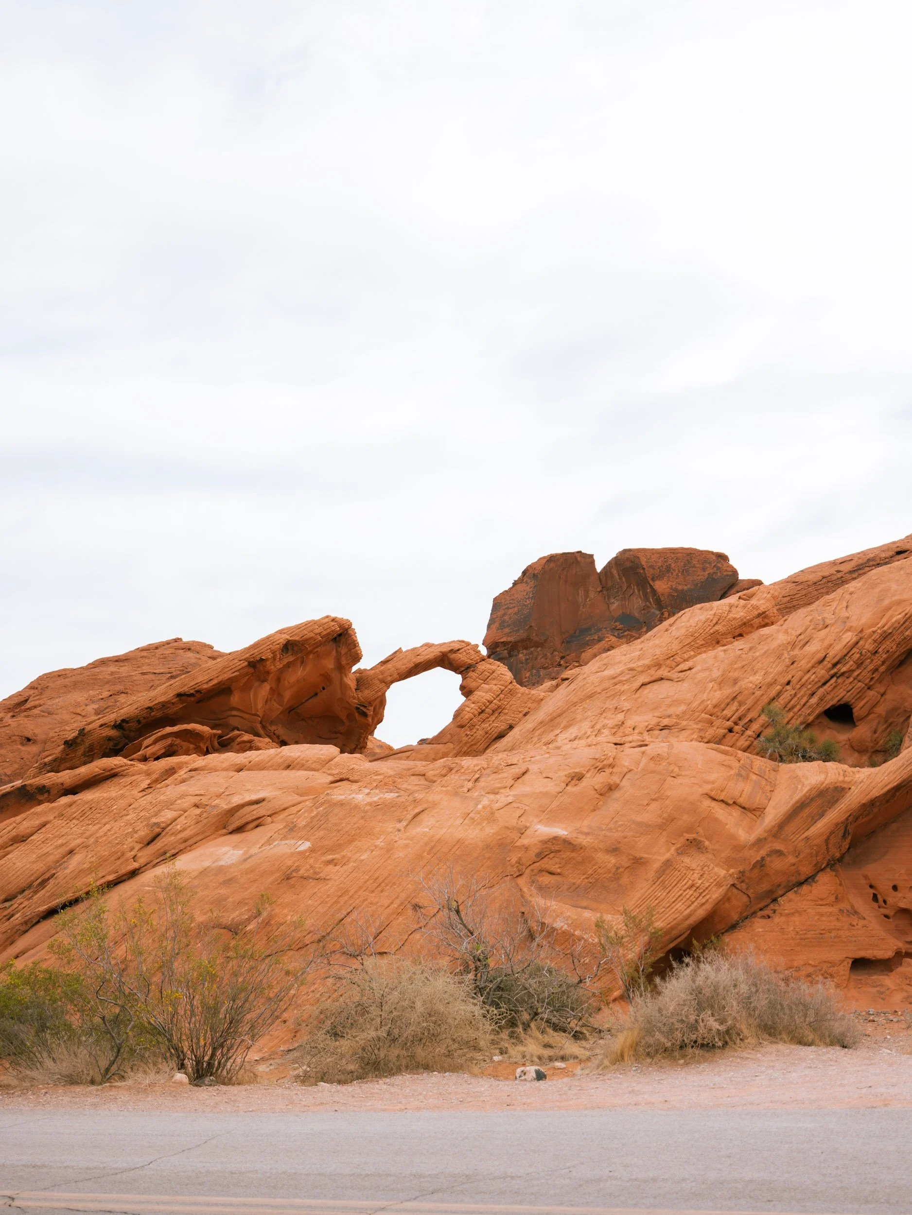
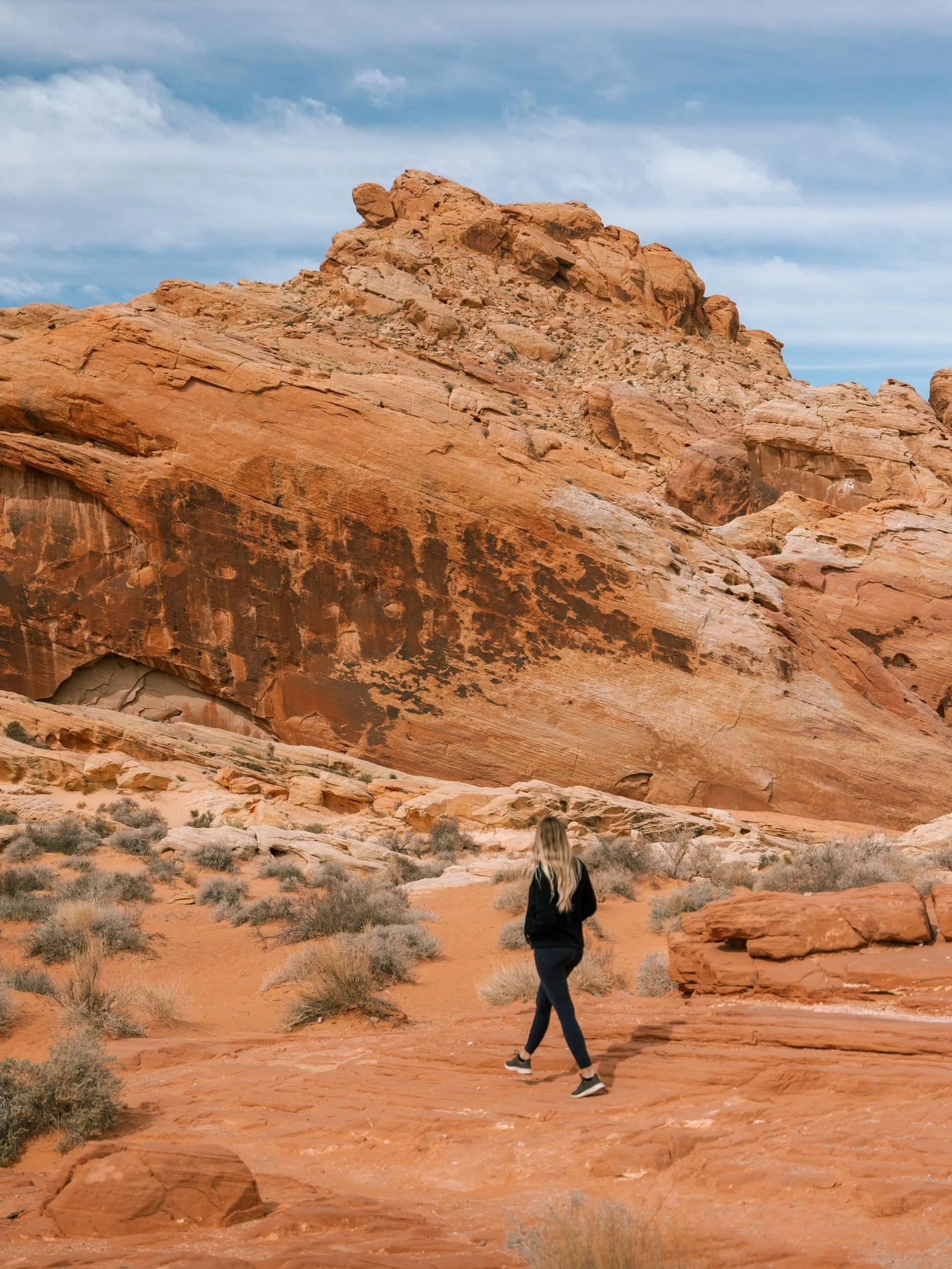
Arch rock
If you put Arch Rock into Google Maps, it will take you to a little pull out on the right-hand side of the road. Once you park, turn around and walk back a few steps – then look across the street! You’ll see the cutest little arch.
There are signs around telling people not to climb the rocks. Be sure to respect and follow all signs! This is not like some other parks where you can climb around.
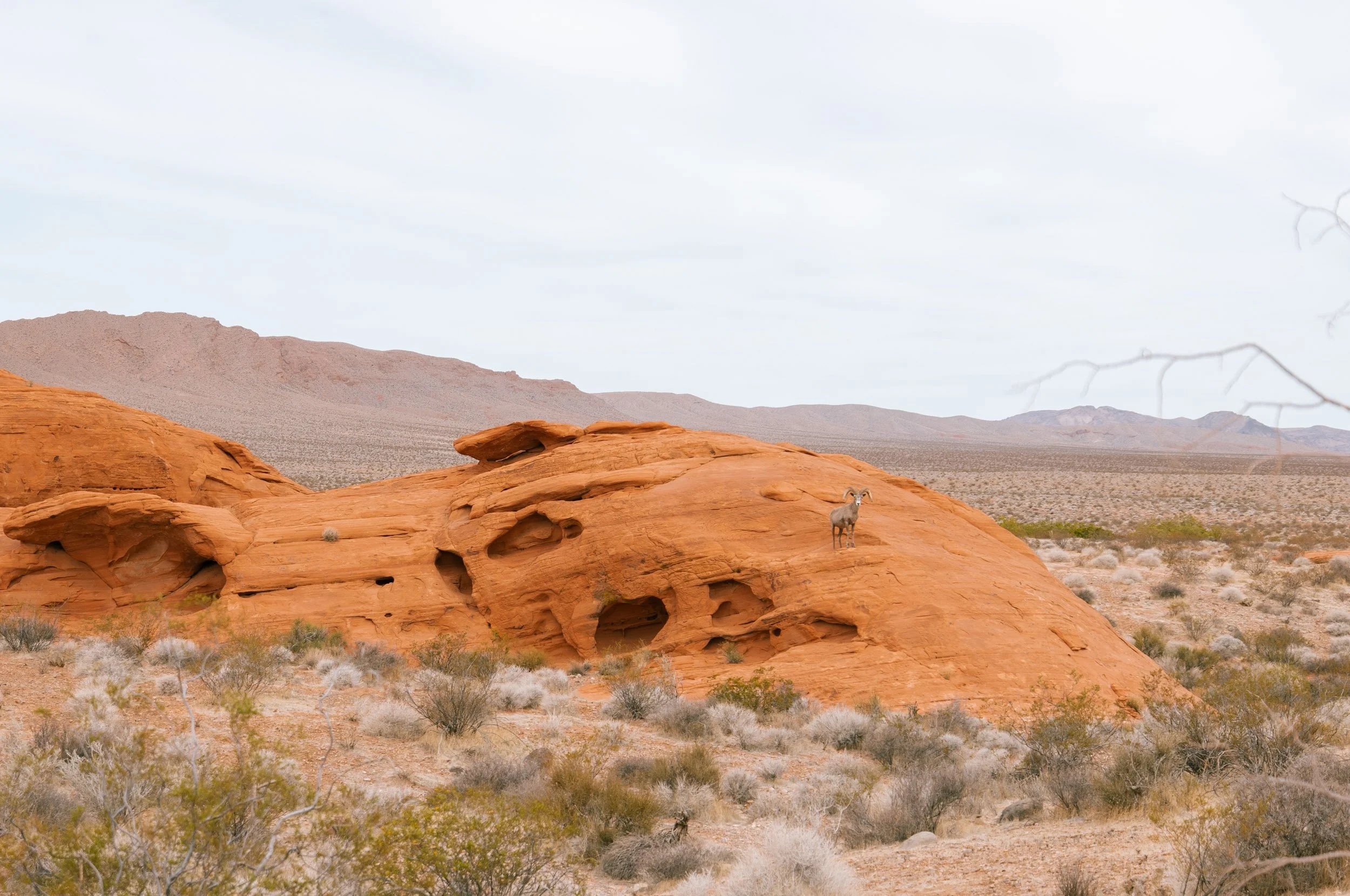
Wildlife Spotting
As we headed to the next spot after Atlatl Rock and Arch Rock, a few cars were stopped in the road. They pointed and we followed their signal to see a bighorn looking majestic on the rocks! We pulled over, took some photos, and admired from afar.
Be sure to give plenty of space to wildlife and do not disturb it. You’re in their home!
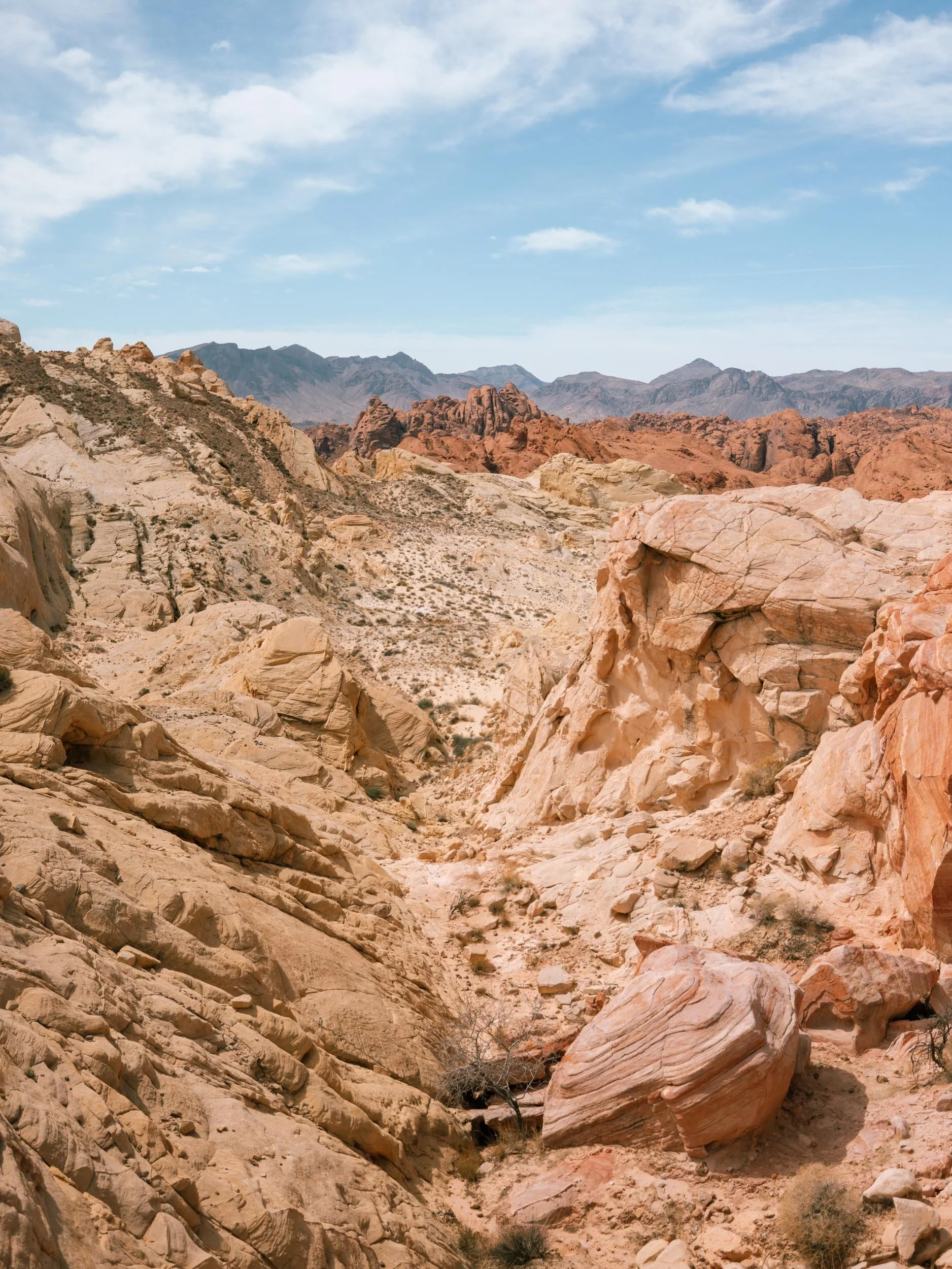
Fire canyon
I misremembered the name of the Fire Wave, thinking Fire Canyon was the incredible swirls. We parked and hiked a trail thinking it led to the Fire Wave. Nope. We walked almost 2 miles on a path that eventually disappeared to see more of the same rocks.
Stick to the lookout from the parking lot here, unless you’re up for an adventurous walk through cacti and dirt.
Mouse’s Tank
We didn’t stop at this parking lot or get out to see the sights, but from the photos I’ve seen, it’s worth a stop!
Rainbow Vista
A bit after the parking lot for Mouse’s Tank is another parking lot for Rainbow Vista. We parked here and walked across the road to take photos and check out the view. There were only a couple other cars here and no one across the road!
Additional Tips
Tickets
You can purchase tickets ahead of time or at the entrance gate. It was $15 for us since we’re not from Nevada – cars with Nevada license plates pay $10 to enter.
The America the Beautiful Annual Pass is not accepted here.
Get the Map
I declined the map when they asked at the front entrance and definitely regret it! We got maps at all the other parks we visited and they were really helpful, even though we had an idea of what we wanted to see. The maps have extra, up-to-date information that you can’t get on Google Maps.
Dress for the Weather
It was pretty warm in April and the sun was strong. Even with 50 SPF, I still got a bit burnt on my face. Pack a hat, sunglasses, and apply/reapply sunscreen!
My recommendations:

Get There Early
Most people arrive at the parks around 12-1pm. We got into the park around 10 and it was pretty empty for the first hour or so! Do the most popular things first (like the Fire Wave hike) before the park starts to get crowded.